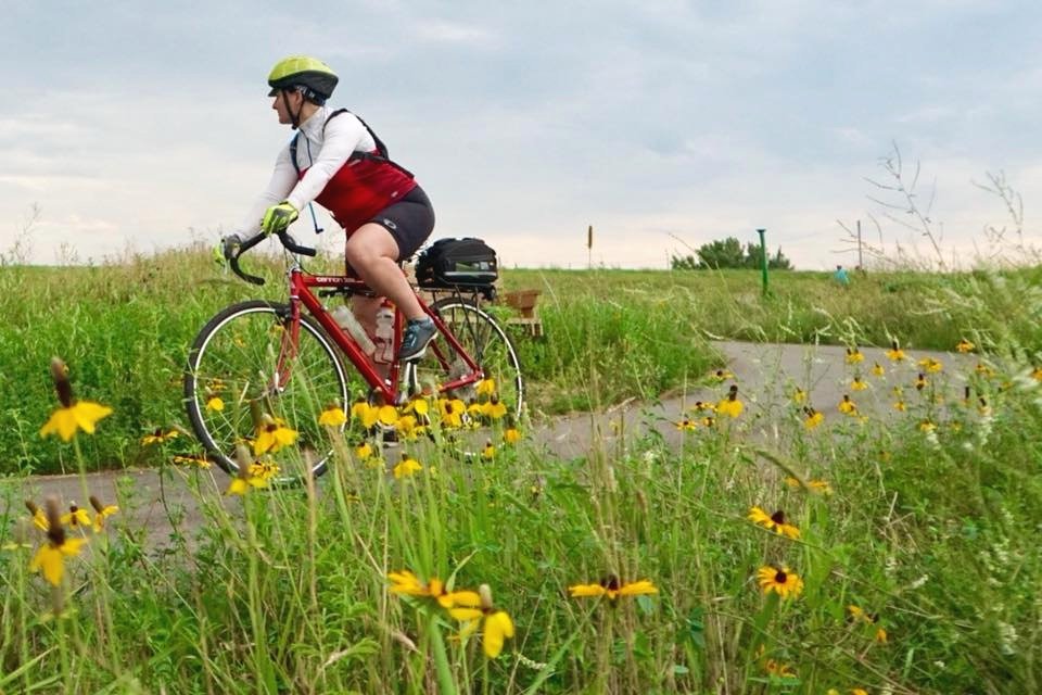
Lake Wobegon Regional Trail
65 miles long, 10 feet wide and paved end to end, waiting for you to explore on foot, bike, or snowmobile.

Lake Wobegon Trailheads
Waite Park
Waite Park Trailhead
Rivers Edge Park is the easternmost access point to the Lake Wobegon Trail. This city park offers many amenities.
Parking
Restrooms with flush toilets
Water
Picnic tables
Benches
Baseball/Softball diamonds
Pickle Ball court
Splash Pad
Playground
Concession Stand (for events)
City of Waite Park
Waite Park Chamber of Commerce
St. Joseph
St. Joseph Trailhead
This trailhead is on the northern edge of town is within biking distance of restaurants and stores.
Parking
Restrooms with flush toilets
Water
Picnic shelter
Picnic tables
Bike Racks
Bike repair station with pump
St. Joseph Chamber of Commerce
City of St. Joseph
College of St Benedict
St Joseph Newsleader
Avon
Avon Trailhead
This sprawling trailhead is in Avon’s Lake Wobegon Park and has an observation tower and a band shell.
Parking
Restrooms with flush toilets
Water
Picnic shelter
Picnic tables
Bike Racks
Bike repair station with pump
Benches
Avon Area Chamber of Commerce
City of Avon
Avon Township
Avon Hills Initiative
Avon Hills North Scenic and Natural Area
Albany
Albany Trailhead
The trailhead has a veterans memorial and shares a parking lot with the police station and library.
Parking
Restrooms with flush toilets (in library)
Water (in library)
Picnic shelter
Picnic tables
Bike Racks
Bike repair station with pump
Albany Area Chamber of Commerce
City of Albany
Albany Public Library
Two Rivers Stearns County Park
Freeport
Freeport Trailhead
The smiley face water tower greets you when you arrive at the Freeport trailhead.
Parking
Picnic Shelter
Picnic tables
Bike Racks
Bike repair station with pump
Benches
Melrose
Melrose Trailhead
Melrose doesn’t have a trailhead building, but trail users may park in the lot across from the grain elevator.
Parking
Bike repair station with pump
Bike rack
Free Bike Rental Program
Melrose Area Chamber of Commerce
City of Melrose
Melrose Public Library
Sauk Centre
Sauk Centre Trailhead
The trailhead in Sinclair Lewis Park on Sauk Lake connects to the Lake Wobegon trail via a short paved trail and features a band shell and a nearby splash pad.
Parking
Restrooms with flush toilets
Water
Picnic shelter
Picnic tables
Benches
Playground
Fishing pier
Sauk Centre Additional Parking: Trail users can also park in a lot where the Lake Wobegon Trail crosses Sinclair Lewis Avenue.
Parking
Small shelter
Bench
Bike Repair Station with pump
Sauk Centre Chamber of Commerce
City of Sauk Centre
Sauk Centre Public Library
Sauk Herald Newspaper
West Union
West Union Trailhead
With a population of 122, West Union is the smallest hamlet on the Lake Wobegon Trail, but visitors are welcome here.
Parking
Vault toilets
Water (hand pump)
Picnic Shelter
Picnic Tables
Benches
Osakis
Trailhead Address:
11 Main St East, Osakis MN 56360
about mile 130
The trailhead is in downtown Osakis about two blocks south of Lake Osakis. There are bathrooms available at the City Offices about 100 feet south of the trail on the corner of Central Avenue and Main Street. Osakis is the point where the Lake Wobegon Trail connects with the Central Lakes Trail.
City of Osakis
Osakis Chamber of Commerce
Osakis Review Newspaper
Holdingford
Holdingford Trailhead
Flower arrangements adorn this trailhead building and a Soo Line railroad car features scenes from Holdingford’s past.
Parking
Restrooms with flush toilets
Water
Picnic shelter
Picnic tables
Bike Racks
Bike repair station with pump
Benches
Holdingford Covered Bridge: At 186 feet, it’s officially Minnesota’s longest covered bridge. It was built in 2008 and crosses South Two Rivers in Holdingford.
City of Holdingford
Happy Valley Wildlife Management Area
Bowlus
Bowlus Trailhead
Technically not part of the Lake Wobegon Trail, but the Soo Line Trail has been adopted by the Lake Wobegon Trails Association. This modern trailhead building was designed to resemble the old Bowlus train station.
Parking
Restrooms with flush toilets
Water
Picnic shelter
Picnic tables
Bike racks
Grill
Playground
Highway 10 Trailhead
This is the end of the paved portion of the Soo Line Trail. A large parking area is available, along with vault toilets.
The Soo Line trail continues northeast from this point as an unpaved trail primarily for use by ATV’s. The trail ends just south of Superior Wisconsin.
